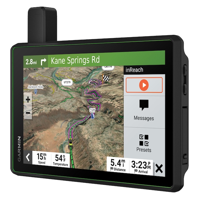
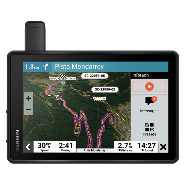
Roam the unknown with Garmin's Tread SxS Edition, the rugged powersport navigator with an 8 in. ultrabright display. Enjoy turn-by-turn trail navigation for traversing unpaved roads and trails. (Limitations may exist in map data for some road and trail route suggestions. Always defer to all posted road signs and conditions during vehicle operation. Garmin OpenStreetMap products are to be used only as a supplementary travel aid and must not be used for any purpose requiring precise measurement of direction, distance, location, or topography.) Stay connected to up to 20 riders with the Group Ride Radio for voice communication and tracking. (Requires riders use Tread. Connection to vehicle power is required for group tracking and push-to-talk mic functionality.) The navigator comes preloaded with topographic maps, U.S. public and private landowner information, and subscription-free BirdsEye Satellite Imagery. With an active satellite subscription, built-in inReach technology offers global satellite communication, 2-way text messaging, location sharing, and interactive SOS. (Some jurisdictions regulate or prohibit the use of satellite communications devices.) Pair your device to the Tread app to track friends using the Group Ride Mobile feature, sync trip data across all devices, and more. (Tracking via Group Ride Mobile requires the Tread app running on your and each friend’s compatible smartphone with Bluetooth technology and an active cellular connection.)
8-in ultrabright, glove-friendly touchscreen; screen and navigator are dust tight (IP67) and can withstand-inidental exposure to water of up to 3.3-ft for up to 30 minutes
Provides turn-by-turn trail navigation for traversing unpaved roads and trails plus enables up to 20 other riders/friends using Tread SxS Edition to stay-intouch with Group Ride Radio; push-to-talk fist microphone; requires connection to vehicle power
Pairs with Tread app on compatible smartphone to track friends using Group Ride Mobile feature; syncs trip data across all devices and plan routes with the same maps, vehicle profiles, and route preferences on Tread device
Tracking requires Tread app running on all friends and riders Bluetooth-compatible smartphones and active cellular connection
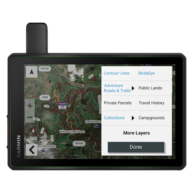
Maps comprised of OSM and USFS Motor Vehicle use maps and City Navigator road maps for custom street routing; takes into account size and weight of vehicle
Limitations may exist in map data for some road/trail route suggestions; riders should defer to all posted road signs and conditions
Garmin OpenStreetMap products are intended to be used only as a supplementary travel aid and must not be used for any purpose requiring precise measurement of direction, distance, location, or topography
Preloaded topographic maps with 3D terrain of North and Central America, US public and private landowner information and subscription-free BirdsEye Satellite Imagery via direct-to-device download
Built-in altimeter, barometer, compass, and pitch and roll gauges help navigate challenging terrain